Wednesday, December 14, 2011

Memaloose - July 2011

Memaloose is a derivation of the Chinook Indian word “memalust,” meaning “to die.”

The Chinook Nation of native peoples lived around the major waterways surrounding modern day Portland since before recorded time.  They built multifamily long houses, fished, hunted, gathered, and celebrated their rich and complex culture.  They thrived in the abundant lands of God's great green earth, incorporating the fog banked skies into the rich tapestry of their lives.


  By the 1830s most of their numbers had succumbed to deadly European diseases to which they had no natural immunity, leaving a vast fertile land ripe for White westward expansion and "manifest destiny".  Their ancient trade routes and powerful spirit places lay dormant and forgotten.  Of course, the places survive, and still pulsing their power and magic.  It is now up to the individual to make their own interpretations and create their own framework.  It is a pity, so much has been lost....so many mysteries lie just below the horizon.

Phil and guardian moon

Memaloose Lake, deep in the Old Cascades of the Clackamas Watershed is just such a place.  How the name fits into Native culture is now unknown; perhaps it was a burial ground or a place where spirits of their ancestors congregate on this plane.


Geographically, Memaloose is a glacial bowl containing a small lake and ancient forests plying the round ridges.  It has always been a popular place with Portland area hikers, and can get quite busy on summer weekends.
  Recently the area has been added to the newly created Clackamas Wilderness, a scattered collection of untouched lands that have managed to escape the saw.  Indeed, the surrounding area has been hit pretty hard by logging, mostly in the past 30 years.  Roads and clearcuts scar this once sacred land.  But Memaloose is still steeped in magic.  Intense peace can be found when She wishes to reveal Her secrets.


Like much of the Clackamas, abandoned trails abound, some Native, some more recent.  All tell of an earlier age with different priorities.  Finding them is a combination of luck, readiness, and the intent of the individual.

long abandoned and almost lost

Can we still hear their voices if we're quiet?

glory in the short summer sun

glowing shores and ancient rockslide

We come to Memaloose with the intent to celebrate these ancestors and to heal old wounds.  Although we come from European stock, we believe that all creatures are united in spirit, and the Creator chose to give us this day of breath.  These miracle places are not to be squandered.  We sing, drum, and pray to All Things, all in mystic celebration and wonder.  We watch the sun rise over Mother Wy'East in gratitude.


  We Americans often lack the cultural context for understanding ancient cultures and sacred lands, including many of the direct descendants of these abused but still proud people.  Life on or off the reservation is frequently tragedy itself.  Sometimes there appears no place to go.
  Without tangible ties to our past, we are all lost, roaming the earth like ghosts.  I am ashamed of some of my ancestors.  I am sorry for what they have done.  I am sorry for what they continue to do.

Tuesday, December 13, 2011

Rhododendron Creek - July 2011

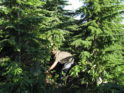
Mighty Petey of the Woods

Rhododendron Creek is an interesting place.
  A long drive from Portland, in an area heavily hit by the "cut and run" craze in the '70s and '80s, it is hard to find much of the ancient in the area.  Most historic traces have been obliterated, replaced by huge squares of young "plantation" forest that will be eternally thinned when young and harvested when merchantable, usually after a mere 50 years or less.  It is difficult for a genetically modified cornfield to revert to native prairie, equally so for a monoculture plantation forest to return to late successional.  Unfortunately the cat is out of the bag.  Our wild lands are so fragmented that they must now be managed lest all be lost.
Yes, still interesting believe it or not, in spite of itself.  Or, in spite of us.

  1938, nothing but trails, guard stations, and wilderness

In the late 1950s as roads and chainsaws pushed further up the Clackamas, the old trails were soon forgotten,  relics of an earlier inefficient age.  After logging, most were too fragmented to follow.  Soon, they were gone.

For some reason, Trail #569 following Rho Creek lay dormant and relatively undisturbed, sleeping in it's ancient bed - officially abandoned by the US Forest Service.  Over the past couple of years, Trailadvocates volunteers have relocated and restored this historic trail, and it is now back on the USFS inventory.


#569 follows Rho Creek, switchbacks, then begins a merciless climb to the top of Rho Ridge where it meets another historic trail following the ridgetop.  Starting in lush green riparian old growth and ending above 4000', the trail traverses a variety of habitats and forest types, from wet ancient Douglas firs to crisp lodgepole pines in the higher elevations.  
Our family has been visiting Rho Creek for a few faithful years now.  It has become a special place to us.

Erin

  But not all progress is necessarily good: a large new trail sign has brought recent motorcycle damage to the lower section of trail, frustrating me to no end.  As a trail restoration volunteer who has spent many hours working on the Rho Creek Trail, I am indirectly responsible for this damage.  What do we do?  Must we ignore our history and sacred places because of a handful of idiots?  It is not even a good motorcycle trail, being steep and rough with deep creek canyons that must be crossed on logs, dangerous even on foot.  How sad after so much hard work.  

vandal cycle mud ruts diverting a small spring

But not all is lost.

 #569 in the long chilly daylight of a Cascade summer


Cascade trails need frequent maintenance.  Trails through clearcut sections are quickly overgrown in the harsh sunlight.  Soon the path is lost.

before

After.  Check out that boulder!

One more time.
before 

After.  Man that's a lot of work hacking through that stuff.


 A skink, I think, in the kinickinick

Mt. Hood Lilly

Down the trail and until next time.


Linney Creek and her Trails - July 2011

It is hard to imagine the warm glow of summer while sitting inside on a cold December day.  The low sunlight dances outside the window casting shadows of the few bare leaves that still cling to waving branches.  They too will soon scatter like used thoughts.  It is also hard to believe that summer will again return for an all too brief spell to bathe us in nature's glories, reborn again and in mere moments lost again, except in memory.  We cling to these memories; in the damp Northwest it's the only thing that keeps us sane.

leaf holding a piece of sky


Let the winds dance, let the crystal cluttered leaves remind us of our own multi-celled nature and the fleeting time of our own age.  Let's talk about Linney Creek Forest Camp.


Linney Creek Camp is a bit of a conundrum to me.  Like many other discarded camps in this post industrial, post clearcut age, it lies near forgotten and at the very edge of our known world.  It's a long drive to get there, and isn't really that spectacular - lying shrouded under our familiar deep canopy, swallowed by rhododendron jungle.  It was most likely constructed in the Civilian Conservation Corps age of the early 1930s, "make work" projects to save young destitutes from themselves and the society they were unwittingly thrust into.

 The road in is long, narrow, rocky and arduous, and due to its high elevation is only accessible for a couple months out of the year before the deep winter snowpack wraps her secrets as presents only to be opened under summer skies.


Constructed in the age of steam by a de-armored WWI tank, an atavism even in it's day, this sometimes treacherous road goes nowhere, ending at this unremarkable place, by Cascades standards at least.  The facilities surely included a familiar outhouse, signs, fireplaces, and picnic tables, but all that remain is a flat spot surrounded by the silent trees.  Effort was apparently made 20 or so years ago to return notoriety to Linney Creek: a campground clipboard tacked to a tree, and signs proudly announce trails that no longer exist, faded calico print from another time.

end of the road

But I court history like an ugly lover, and am not interested in this modern remake.  I am looking for the relics of the older age, and specifically the old trails that predate our foray into mechanized madness.  Like capillaries, Mt. Hood National Forest is rooted in ancient routes.  Most are lost and forgotten and soon to be erased from this age like everything else.
After much hard work searching for these insane miles in Aztec jungle, I am turned back time and time again by Rhododendron Hell, growing 20 feet and higher right out of the old mountain's routes.  Discouraged and bloodied, I am never dissuaded, God knows why.  And then without warning, I discover old blazes heading west over these tangled ridges.  What a feeling of excitement!  And then it becomes clear that these trails haven't felt a foot in many decades. 

marking the way

Following and flagging this vague route is very difficult and takes many hours to travel just a short distance.  It is well blazed, but hard to pretend it's 1925.  Time has moved on in spite of one man's passions.

Randy, or maybe an elf leading the way


Enough!

And then, just as quickly we lose the old trail like a half blind hound.  Tired, we return to camp for the welcome solace of beer and a nice fire to enliven the night.  But I dream of horsemen and their bones.  In the shining morning I am eager to search and stumble again, to open fresh wounds and nearly break my legs again and again.  Why must history exercise a sadistic streak?

A fisherman was born on this trip.  Randy, here fresh from the baked streets of Los Angeles has discovered the peaceful joy of waiting for fish with baited hook and line.  He is now lost in swimming thoughts and useless to me.  Luckily, ancient woodsman Don is here.  We will find that damn trail.  And we do.

 angel from another age

Not to be deterred, we hack our way through the now known section of trail.

  We then climb up, up, up, and over.  We stumble through tangles of huge trees blown down in furious winter storms.  We squeeze through thick tangles of brush like a constipated man seeking sure relief.  I fall through gaps in the tangle and nearly break my leg, again.  But the blazes are like the sun, fierce and guiding.  The old tread somehow survives and guides us ever further west and over a saddle.  I am exhausted but wholly delighted.

me

Imagine!  A man has not ventured this way for 30, 40 years, maybe more.  The forest sleeps, oblivious to our dreams and reconstructions.  The trail is still there, but only survives as a dream.  It will take much work to make passable again, a route to and from Nowhere.


This present generation has the unfortunate task of containing, reviving our history at the eve of it's erasure.  But how much can a couple guys with hand tools accomplish, following inaccurate maps from 80 years ago?

  Then the next new season unfolds.  The deep snows melt and new seeds take sprout.  These old lines on a map become ever fainter.  Our own hands will in time wrinkle and fade, leaving these new dreams as autumn leaves.  They too will blow away, to be replaced by the next, and so on into infinity.  It's how it all must be.  

 But some things never change.

Grouse-Huxley AKA "Mud Camp" - June 2011

Perhaps you remember an earlier story about the infamous "Mud Camp" expedition of a couple years ago.  Perhaps I am lying in a ditch, twitching as I imagine this fanciful tale.  Who can tell?  I guess it's not that important.
To me, "Grouse-Huxley" sounds imperial, important, like a high society gent from the 1930s.  Nothing could really be further from the truth.  In fact, this bruised land is a muddied mess available only to those who duck old ghosts and have the nerve to drive miles of "road", really just temporary railroad grades that have almost completely reverted to nature, seeming more like a deer trail now.  Branches scrape your vehicle, mystery mud puddles without bottom dare you to continue.  "Does this go anywhere?"  Sort of...

After many miles of this adventure, you begin to wonder what gem lies at the end.  After each insane dip and washout you know the journey will not prove wasted.  Sort of.  But once you get there you realize that you are in a deep wilderness combined with the sensibilities of an abandoned factory town.  The south side of Chicago invokes a similar emotion.  Once booming and filling the air with coal smoke, entire industrial neighborhoods have again reverted to nature, former factories sprawl immensely and forlorn, structural supports now as gentle as balsa, where forest again tries to maintain a foothold in failing concrete and generations of rust.  
It is indeed strange to have such feelings invoked deep within our temperate jungle, hiding bears and other unseen energies deep within the tent of forest and suspended reason.  But around the unsure perimeter of this human induced change, ancient spirits still do their dance.  Of course some day they too shall pass, like everything else.

Grouse-Huxley really does sound imperial, doesn't it?  In truth I must confess that the name came to me in a state of near delirium after many days of thinking far too much and hanging out with the most sordid sort of scoundrels.  In truth, it is just the midpoint between Grouse Point, a high ridgetop viewpoint now choked with growth, and Huxley Lake, an ancient glacial water body now choked with the disregard all too common in our age.  ATVs, the four-wheeled snorting beasts, have done a fine job of destroying almost all sense of history, creating a muddied mess of miniature roads in what has been recently designated the Roaring River Wilderness in no small display of irony.  This must be how the Native Peoples felt when the brass bedecked iron horse first snorted its way across the Dakotas.  Huxley survives, in flux as do we all.  Mud is as malleable as clay in a potters hands, a refuge for seeds and spores that lie locked just waiting for time and opportunity to release their contained magic.  You just can't keep a good seed down.


 I'm not sure why I go back to the place.  Really, it's quite a mess and not quite worth the insane trip in.  It's wilderness to be sure, but lacking the big trees and scarred like a Pharaoh.  Deep cuts and grades for railroads deemed "temporary" 100 years ago still survive as clearly as any Roman aqueduct.  Clear the trees and lie rails and little change would be evident.  But something beyond the tangible lurks there, heavy like fog.
    
 The locomotives are gone, the men are gone, as are the old trees.  Are they all still assembled together in some unseen place and way?  We have such a narrow framework which we view the world.  Einstein and his 2 ways to view the world: "all miracle or nothing".

This trip, I chose not to document the weird goings-on of 3 odd fellows deep in forgotten new trees.  Sometimes as memory fades, we turn to photographs to kindle a sense of the lost.  In time, the photographs themselves become the memories.  My mind tells of expeditions to the Roaring River flowing like mercury, or dancing along the back of an emerald snake that exists only in the imagination.  We try to imagine what these woods were like when crosscuts sang or solitary mosses do their timeless dance, only aware of the wind and cotton sky hanging leaden.  For a time these dreams take hold, replaced by passing jets or our own new laughter.  We too will be forgotten.  


Don, Randy, and Murphy

Monday, July 18, 2011

Pot Creek Cabin Camp - May 2011

History is a remarkable thing, ever fluid, ever elusive.  With our increasingly mechanized world, wonders of the even recent-past have a habit of quickly vanishing from the public consciousness.
Before roads, trails were the only way to cross our tangled Cascades.  People journeyed in ways most basic - by foot, or by horse.  Suitable camps become precious places, especially after a many-day trip into deep wilderness.  A flat spot to rest, suitable browse and water for man and horse, all crucial things we now take for granted.  It is hard to picture an unroaded Oregon.  Unfold the logging roads, you can get to the moon and back.  But as recently as the 1950s this wasn't the case.  And granted, in some places time seems to stand still.
1938 MHNF map 

What fun is this snorting beast History if we cannot at least hunt for her elusive tracks?  In places where strip malls fear to tread, time does seem to pause.  In the earlier part of the 20th century, Pot Creek Cabin was such an important place.  Although I have never seen a photograph of the cabin, other such utilitarian forest structures were pretty crudely built of local materials, all by hand.  They were usually a day or so journey from  the city, and located in a perfect place to spend a night or 2.

Bagby Guard Station, a similar structure

Can you see the cabin?  

It is strange to sit at the Pot Creek Cabin site.  The camp is a nice, open, level area surrounded by old growth forest.  It has been abused somewhat due to proximity to busy summertime roads, so it can be difficult to picture the vast wilderness once crossed to reach this welcome spot of frying bacon and comfortable conversation.  But when the sun is just right, the mists of time can be pierced for a time, and 1922 slips slowly into focus.  Imagine the tired horse and mule teams milling about, resting under tall trees.


Even in those days, a man was a man, and the call of beer was probably deep in his mind, especially down miles of dusty trail.  But he probably didn't emblazon his baser thoughts into the bark of an ancient sentinel.
However, in this Modern Era, we have quick access to rare places and odd materials, so mischief soon ensues.  Well no matter.  An hour patiently scrubbing with a wood chip and the vandalism is lost and I can get back to my pretending.
No more beer

But there is more to these hubs of history then the moldering depression of a lost cabin.  When there are old camps, there are trails, usually also lost to time and jungle.  I am always surprised that those very men and women who knew and loved these forests would allow so much history to fade unnoticed by our modern eyes.  But time and time again, I am able to find the splendid ruins of the best part of our civilization.  What could symbolize our gentle collective in a better way than an ancient route snaking through timelessness?
So with these lofty and romantic thoughts in mind, we set out to find the remains of our forefathers.  What is left?  Does anything remain of 100 years ago?  It is always a crap shoot.


But the sun does shine on this fine May day, and with hard work we are able to find the old trail as it climbs it's way out of the deep Clackamas canyon.  It has been many years since this deep tread has felt the touch of boot, but the route still manages to survive despite time, weather, and clearcuts.


In those days, electronic communication was in it's infancy.  The many scattered Forest Service guard stations and outposts were kept in constant contact by cast iron phone lines strung between trees.  At suitable intervals, the line passed through ceramic insulators, tacked somewhat loosely to tree trunks.  This would prevent the line from breaking if a tree were to fall.

Ring of the past

Can you imagine the conversations that passed through this thin line?

By the 1940s things were changing.  Radios soon put an end to the old fashioned telephones.  Roads soon made the grueling trails obsolete as we moved to a strictly petroleum based society.  Later, historic structures were destroyed and trails left to the elements as progress disguised as this beast Technology leads us by our upturned noses.

Some ancient forest valleys were clearcut right to the creek


And yet, the mountains survive, carrying the microscopic seeds of an entire ecosystem upon their flanks.  Perhaps they just sit at laugh at our futile efforts at our own eradication.  Time exists in a different way for them.  It is this way that we may move beyond human, as we try to come to grips with unknown forces greater than our comprehension.  It is through our mistakes that we may gain our own perspective.  Looking back over our shoulder as we hike this trail of life, we can not only see where we've come from, but where we are going.

UPDATE:
I recently received the following emails from a nice fellow that used to hike into the Upper Clackamas back in the '40s and 50s.  A lot has changed!  It sure is nice to be provided with another piece of the puzzle in this nebulous and ever changing world.  Thank you Gene!


Saw your post on line about the Pot Creek Cabins.  I was looking for photos of them if they exist?
We used to hike into the Big Bottom in the late 40’s and early 50’s until the Eisenhower regime declared war on the old growth in that country.  In the late 40’s it was necessary to hike in from the junction of the Collowash.  In the early 50’s they pushed the road to several miles above Austin Hot Springs and the trail started there.
There were two cabins at Pot Creek.  One was a log structure with bunks around the wall, a table and a good wood stove.  It was usually open to use – people didn’t trash things in those days.  There was a smaller second building just to the west of the main building and it was always locked up and appeared to house a good number of supplies.  The big cabin was a warm retreat on winter days if you went into that country at that time of the year.  I don’t think the cabins lasted very long after the road was punched in.  I am unsure if they were torn down or vandalized to the point that they had to be torn down?
I seem to remember being told that the cabins were the property of Portland General Electric. I know PGE ran the Austin Hot Springs campground for a number of years and in early times they planned a dam in that area to flood the upper Clackamas and the Big Bottom.  I wondered if they or the Forest service at Estacada would have some old photos?  I will try around and see what I can discover.  If I find some I will forward them on.
As well we visited the old station and bath houses at Bagby when it was a 15 mile hike to get there.  Again, folks didn’t trash things then so it was a very serene and peaceful place to go.

Regards,
Gene M.
BendOregon

Good to hear your enthusiasm. Keep up the good work and keep me posted.
You are welcome to post anything I send. By the way, there was a cable
crossing across the Clackamas where the Rho trail went south. Don't know if
any of the remnants are still ther.
My father used to take the speeder (he said) to Three Lynx to fish. I gues
there were tracks that predated the roads. In the 50's and 60's the log
truck traffic on the road to Estacada was enormous (I am sure it was worse
in the 80's). The Log trucks took the outside on the curves and if you
didn't follow the postings you were in trouble. Some friends lost all three
of their children a ways above Estacada when their VW was headoned by a
loaded log truck.
I often fished Roaring River from the main road up about 3 miles but not
above that. We travelled some in the Salmon River Watershed as well and had
an interesting trip to Plaza Lake and then down the South Fork to the
Salmon. Again, the lower Salmon Canyon was fantastic before they put the
road in but at least the very extreme canyon of the middle Salmon has saved
it.
When we went to Plaza lake there was just a rough trail down to the lake
from the road. We bushwhacked from the lake to the South Fork Salmon and
then down to the Salmon proper. There used to be a neat shelter just
upstream of where the South Fork came in and on the south bank of the
Salmon. Hambone Springs sounds familiar but I can't really recall it.
Don't want to pass along wrong information. The cable crossing, as I
remember, was between the end of the road above Austin Hot Springs and Pot
Creek and crossed from the north bank to the South Bank. I think it was a
trail that went to Mt Lowe but that is a bit foggy since we never crossed
(the gondola was always locked on the north side) to see where it went.
Talk to you later.
Gene