A lot has changed outside this canyon, including outside encroachment from a century of logging, farming, and sheep herding. Some roads cut across ridges as fresh scars, although their lines show on maps 100 years earlier.


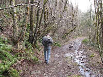


Once down into the Eagle Creek canyon, you are in a wet, low, and marshy rainforest of towering ancient trees. This has always been a difficult place to maintain a linear path. Winter storms toss tress about like matchsticks, leaving fresh trunks and limbs scattered about each season. Once, the US Forest Service crews would repair these trails each spring. But now, there are only a handful of volunteers who accomplish the work.


We hike a few miles up river, but as the early afternoon light begins to fade, it's time to head home. We take solace that these winter days are getting ever longer. A wet March is just around the corner, followed by an April thaw and eventual access to the high country. Winter is a long time to wait.


Abruptly bracketing the ancient valleys of the Salmon-Huckleberry Wilderness are a strange mix of family tree farms and industrial private logging lands, small homes and farms competing for space and dominance.
It is an often ragged clearcut land that is sometimes hard to stomach under leaden winter skies, with plentiful mud squishing under foot or tire. It is hard to believe anything is left beyond these borders. This western edge of the Cascades has long been the destination of Indian trails and the steam logging railroads that followed, each gone into the mists of time in their own way. But both points of polarity have left their mark that we can still see today.

Getting the good boots on

Standing at a crossroads from the 1920s at the edge of wilderness.
Don and Murphy are my first revenue customers for 2012! Thank you guys!!!

And down, down, down, back in time almost 2 miles down an old railroad grade under sheltering alders.

In spite of cutover lands, the wilderness boundary has moved a mile further west due to the Lewis and Clark Wilderness Bill passed a couple of years ago. I am glad to see these additions occur in such highly vulnerable areas which have already been subjected to generations of very heavy logging. Once it's gone it's gone, for now at least.
As we dropped ever deeper into the Eagle Creek canyon, we are alerted by the sharp screeching cry of a predator circling the trees above. We soon discover why: lunch.

A grouse picked apart cleaner than a grocery hen

Redtailed Hawk patiently awaits
Besides logging and other human induced change, fires have been a frequent visitor to these lands. Indeed, they have evolved together, both forces working to renew the land and spread the seed of a new ecosystem onto the charred flanks of this very wet world. Oregonian newspaper articles rave about very serious fires in 1910, 1911, and 1919. In 1933 this devastating cycle begins again. Blame is placed upon human caused sparks and lightning during extremely dry summer conditions.

The Oregonian 7-2-33
But the deep cool and dark canyons of Eagle Creek were spared from these frequent cataclysms.
Once into the hushed forest, you enter a land beyond time.

This bridge is a rare survivor from a much earlier age. They just don't hold up to all the rain and rot.

Once down into the Eagle Creek canyon, you are in a wet, low, and marshy rainforest of towering ancient trees. This has always been a difficult place to maintain a linear path. Winter storms toss tress about like matchsticks, leaving fresh trunks and limbs scattered about each season. Once, the US Forest Service crews would repair these trails each spring. But now, there are only a handful of volunteers who accomplish the work.


Murphy looking quite insane. Not to be trusted with gloves or lunch.

budding huckleberries advertise a rapidly approaching spring


It is always quite dark in the canyon bottom, with the thin ribbon of river glistening with impossible drops and roaring to the sea, rushing past cathedral pillars of very old trees.

But sometimes the sun sneaks out and bathes the world in emerald halos in this freshest place on Earth. There is the constant sound of dripping, each a tiny lens to frame the sunlit forest suspended from a billion tentative fingers.


Very heavy hang the accumulated mosses and lichens, finding a foothold on a forest of branches and bark. The are not parasitic; their presence neither benefits nor harms the trees. But they create a perfect soundproof room outdoors as the green canopy hangs suspended by great puffs. The ground is soft like a great sponge.

Very old friends

Shelf fungus indicates a dead or dying tree. Even in death, this old timer will still benefit the forest for centuries as food, habitat, carbon store, and countless other ways.


A scene that has changed little in thousands of years

Ancient cedar snags


We hike a few miles up river, but as the early afternoon light begins to fade, it's time to head home. We take solace that these winter days are getting ever longer. A wet March is just around the corner, followed by an April thaw and eventual access to the high country. Winter is a long time to wait.

And then *POP*! On the way out and up through a very different forest.

What a wonderful day to be in the woods! What a day to be alive.

And to top off a wonderful day in the woods, what could be better than a fresh pint from Fearless Brewing?
Thanks guys for a great day.